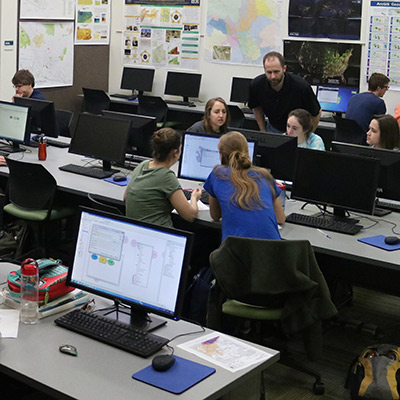
 The Environmental Science GIS Laboratory provides a hands-on environment for exploring how geospatial technologies can be used to understand environmental systems, solve problems, and support informed decision-making. Students work with geographic information systems (GIS), global positioning systems (GPS), remote sensing and image processing, and small unmanned aerial systems (sUAS) across desktop, mobile, and web-based applications.
The lab supports coursework, faculty research, student projects, and experiential learning opportunities involving the collection, management, analysis, visualization, and interpretation of digital geographic data. Students develop practical skills in geodatabase design, spatial queries, geoprocessing and modeling, cartographic design, image interpretation and classification, and GIS-based multicriteria evaluation using both vector and raster data.
Our facilities and equipment provide opportunities to work with real-world environmental datasets and contemporary geospatial technologies, including ArcGIS Pro, ArcGIS Online, QGIS, TerrSet (IDRISI), ArcGIS Field Maps, ArcGIS Survey123, and ArcGIS Drone2Map. The lab’s sUAS and GPS resources further extend learning into field-based data collection, high-resolution aerial imagery, precision positioning, and remote sensing.
Through these technologies and applications, students gain experience transforming geographic data into meaningful information and developing the analytical and technical skills increasingly used in environmental science, resource management, planning, conservation, and related fields.